National Mall
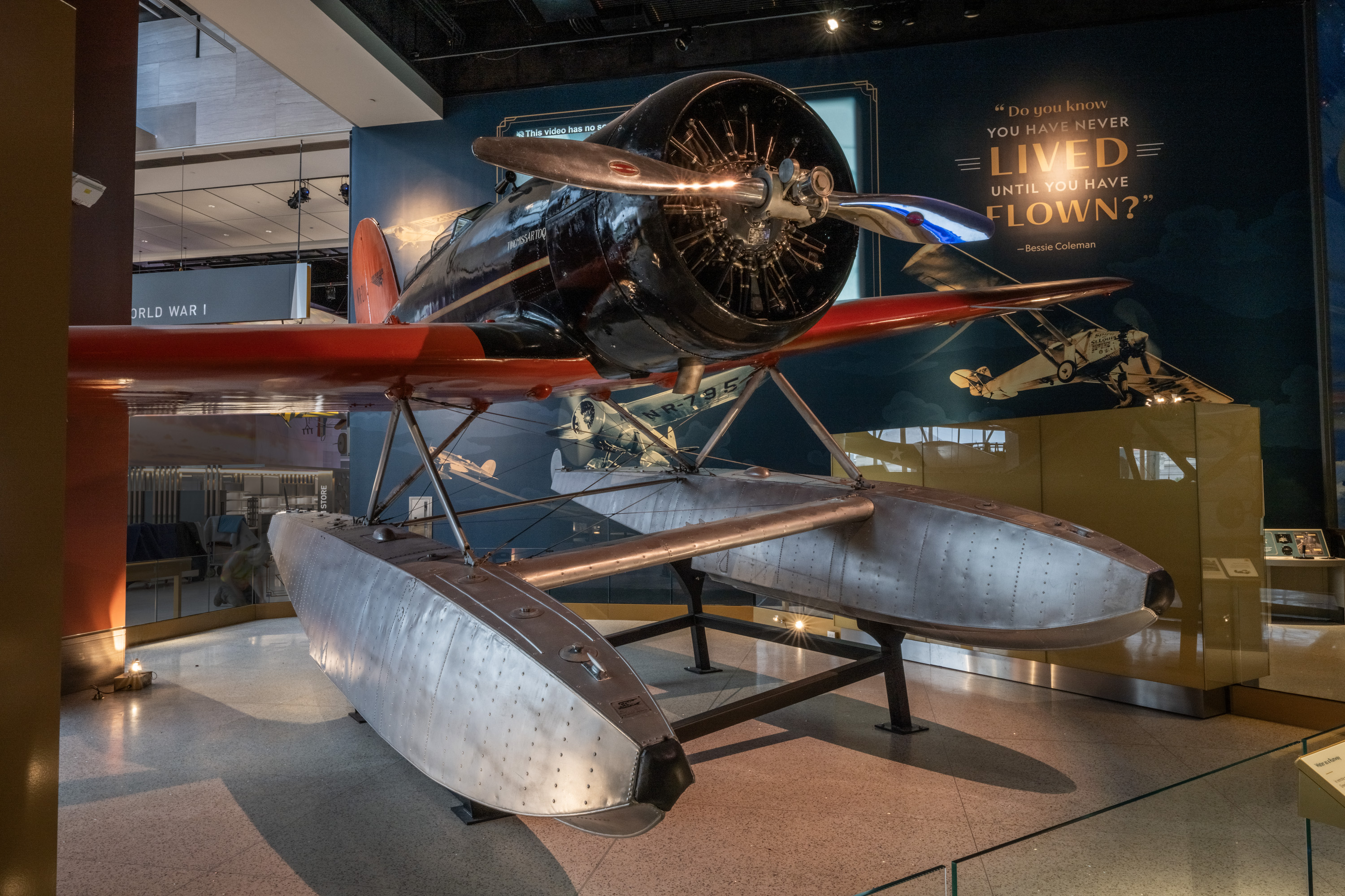
Lockheed Model 8 Sirius Tingmissartoq
Charles and Anne Morrow Lindbergh used Tingmissartoq to survey possible air routes. Floats let the airplane land on water, and navigation instruments helped the crew study long paths across unfamiliar regions. Tingmissartoq joined adaptable landing gear, weather protection, navigation instruments, and a strong monocoque fuselage. Anne’s work as navigator, radio operator, and recorder was essential to turning each flight into useful route information.
In depth
The airplane was a field laboratory
The Lindbergh surveys helped translate remote geography into potential commercial air routes. The aircraft’s floats and instruments reveal that aviation infrastructure is partly physical and partly informational: weather, radio, maps, landing sites, and procedures.
Finding the way, then trusting it
The view from the cockpit can be wonderfully clear, or it can disappear into cloud, darkness, smoke, or unfamiliar terrain. Aviation navigation developed to bridge those conditions. Maps and visual landmarks worked alongside compasses, clocks, radio signals, instruments, and increasingly sophisticated calculations. Each new method changed what routes and weather conditions could be attempted, but it also required training and a clear understanding of its limitations.
The challenge was larger than keeping one airplane on course. Busy air routes needed shared procedures, reliable communications, and ways to separate aircraft that could not see one another. A beacon on the ground, a radio in the cockpit, and an instrument trainer belonged to the same expanding system. The result was an ability to operate more regularly instead of waiting for ideal visibility.
Navigation also connects aircraft with spacecraft. Both depend on measurements, reference frames, timing, and the interpretation of signals. Their environments differ greatly, yet both require people to decide whether the instruments are describing reality correctly. Comparing a route beacon with a satellite or a cockpit instrument makes that continuity visible. The extraordinary flight is often supported by something deceptively modest: an accurate clock, a dependable signal, or a practiced procedure followed at the right moment.